


Catenary Maps: The Best Transit Map for Enthusiasts
Trying to track down a rare train? Look no further than this new transit map app.

A quick overview of alternatives
Especially if you’re a public transit pro, you’ve probably come across a wide range of different trip planning apps. Of course, there’s the default Google and Apple Maps apps—but let’s be honest, these aren’t very good for serious transit use. Sure, they technically “support” public transportation, but you can usually only see rail lines by default, and if you’re looking for specific bus routes or arrival times, it’s a struggle. To be honest, it’s practically useless if you’re in a city with a complex or dense transit system and trying to fiddle around with clicking on the little ‘bus stop’ symbol.
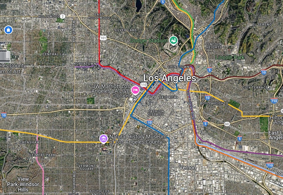
Google Maps’ default transit view looks clean, but it’s too clean—it lacks the details transit users need. There’s no way to easily explore all the different bus routes from a glance, and live arrival times are hidden behind bus stop buttons. Half of the time, looking up a specific bus route doesn’t even work on Google Maps. Honestly, the only good part about Google Maps is the transit-planner, but if you’re in a rush and just trying to find arrival times, good luck.
Then there’s some more advanced apps, like Moovit and Transit App. Moovit has great coverage, especially with niche operators, such as in Costa Rica, which don’t have public GTFS and have hard-to-find timetables. Unfortunately, the ads on Moovit are far too aggressive. Every time you try to navigate through the app, you’re constantly bombarded with ad upon ad. It’s not a good experience, especially if you’re in a rush and trying to get quick arrival times. Just like Google Maps, although the in-advance transit planner is quite good, reaching arrival times quickly is a bit of a hassle.
Transit App, on the other hand, is my daily driver. While some features (like non-local bus routes and extra transit routes) are paywalled behind a subscription, the core experience is excellent. It’s quick, intuitive, and gives you the basics—real-time arrivals, trip planning, and route overlays—without unnecessary clutter. It works well for most people. But if you’re someone who wants to dig deep into a transit system, it still feels a bit surface-level.
But now there’s a new competitor, especially for those who want nitty-gritty levels of detail on their map:
Catenary Maps
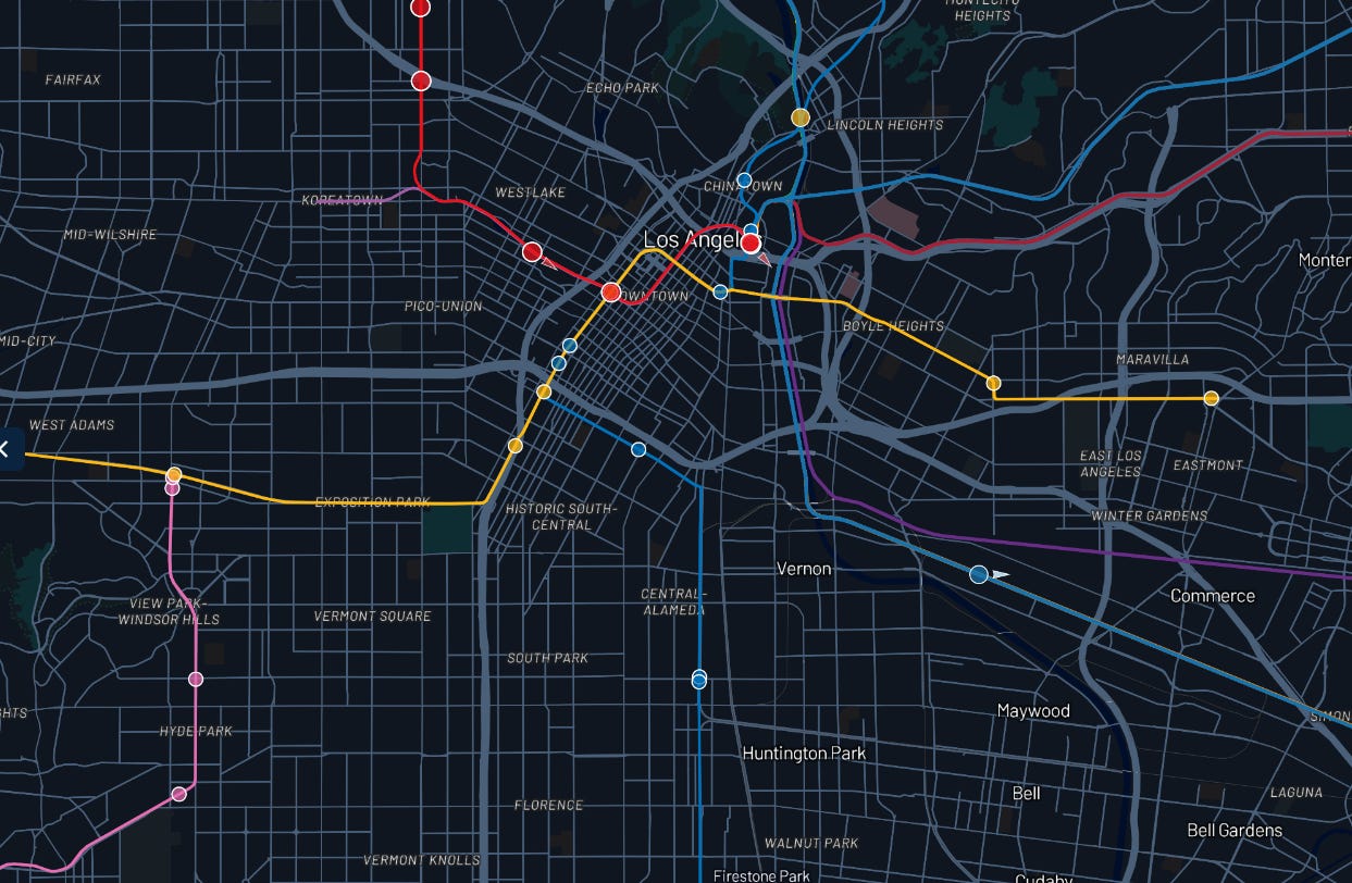
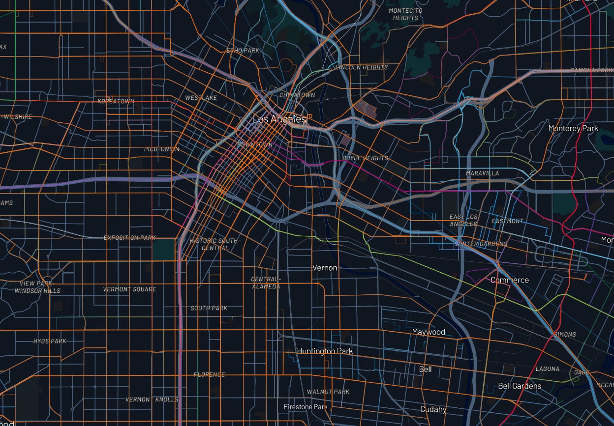
This new transit-tracking app was tailor-made for transit fans, foamers and power users everywhere. Unlike it’s competitors, not only does it give you live arrival times, but it also shows you a complete bus system map and gives you information about vehicle’s model, agency and more! Catenary gives you a full system map for every agency it supports— over 7,000! —with more being added constantly.
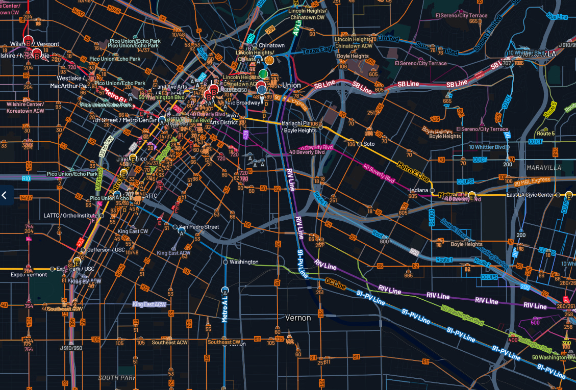
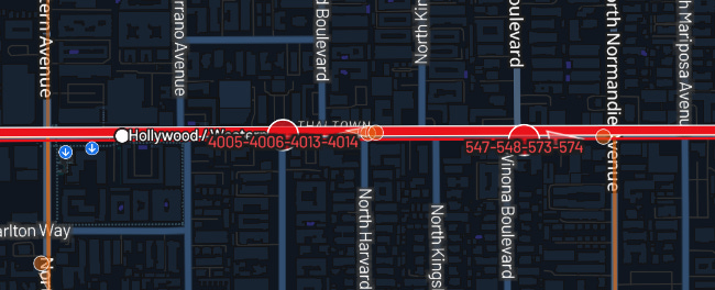
At first glance, the map might be overwhelming, and look cluttered and messy. However, compared to the other transit apps, this map is jam-packed with information. You’ll be able to see bus routes, vehicle ID’s, rail corridors, stations, bus stops, all at the same time. The fact that I can actually visualize bus routes on the map is a game changer, while other apps require you to first manually select or search for the route. The map is also heavily customizable, and you can turn off bus routes, rail routes, labels, and tailor the map to your liking!
Catenary is also a super useful tool for all transit enthusiasts. Customizing your map, you can look for specific vehicle IDs. With Catenary’s vehicle ID view, you can track individual vehicles by their model number or fleet ID. When LA’s new CRRC HR4000 cars launched, we used Catenary to watch them live, tracking each car’s location in real-time across the city. We also used Catenary to track down Foothill Transit’s Enviro500 double-decker, as well as Long Beach Transit’s new electric motorcoach and Santa Monica Big Blue Bus’ new all-electric ecobus. All of this, and it just took a few clicks to filter out everything except those rare vehicles we were tracking down.
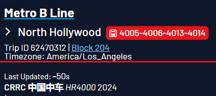
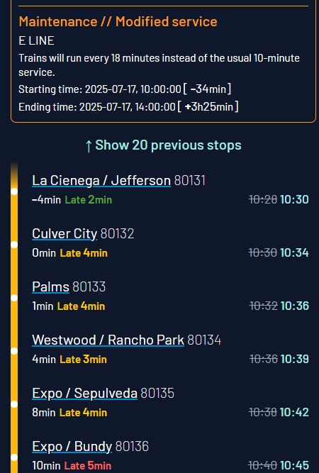
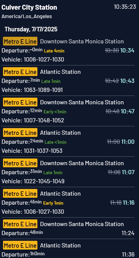
Want to know exactly when your target vehicle will arrive? Just tap it. You’ll get detailed arrival and departure times at every upcoming stop, along with the full route it’s taking. Maintenance alerts, service disruptions, and reroutes? All right there on the same screen—no digging through submenus or alerts pages. It’s super refreshing to have live arrival times, maps, and service alerts all within clicks of each other, in a clear and concise interface.
Conclusion
Another thing that sets Catenary apart: it’s open-source, which means it’s being built transparently, with input from the community. The developers are super active, and they listen to feedback directly via their Discord server. You’ll often see new features being added weekly, and new agencies being rolled out based on user suggestions.
Catenary is one of the best tools I’ve used on my transit adventures. Catenary supports tracking over 7,000 transit agencies from across the globe, with more being added daily. I’ve used it to track down rare trains, buses and just check it for arrival times. You can check out the map for yourself here: https://maps.catenarymaps.org/.